Hurricane Irene
Good Morning,
As all are aware the country is once again under threat of impact by a major hurricane.
The Bahamas has not been impacted by a major hurricane during the past three years.
In September, 2008, Inagua took a direct hit from Hurricane Ike, while the remainder of the country was largely spared any serious impact from the storm. That experience must not be permitted to lull us into a state of complacency about hurricanes.
I am reminded also that today marks the 19th anniversary of the arrival of Hurricane Andrew in The Bahamas in 1992. Nineteen years ago Andrew, the first hurricane of that season, wrecked havoc on a number of our Family Islands, principally North Eleuthera including Spanish Wells and Harbour Island; Cat Island, Abaco, Chub and Cat Cay. The lessons learnt from Andrew set the stage for hurricane preparedness and response in our country and led to the formalization of emergency response in the National Emergency Management Agency (NEMA).
In the years following Andrew, we withstood the impacts of Hurricane Floyd in 1999, Michelle in 2001, and the terrible cluster of Hurricanes Francis, Jeanne and Wilma between 2004 and 2005; these latter so severely impacted Grand Bahama Island that the islands’ economy has never fully recovered.
Our concern and attention today must be trained on the most serious threat posed to our country by Hurricane Irene. I advise all residents to take the warnings issued by the Department of Meteorology seriously and to complete all hurricane preparations immediately.
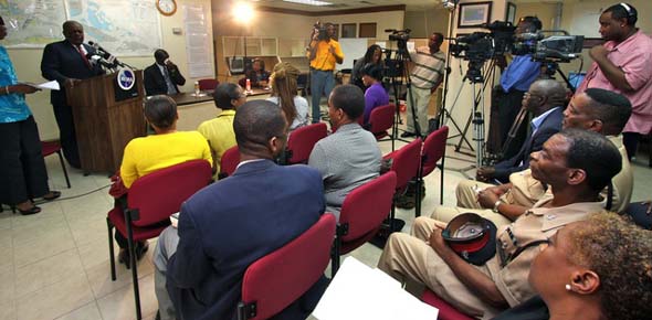
I am pleased to be able to report this morning that NEMA has given me assurances that all official preparations for Hurricane Irene are in place. At 6 p.m. yesterday (Monday, August 22, 2011), officials at The National Emergency Management Agency, NEMA, activated the National Emergency Operations Centre (NEOC) for the entire Bahamas as a hurricane watch has been issued for the Central Bahamas because of Hurricane Irene.
NEMA met with members of its Emergency Support Function Committee yesterday afternoon to update the relevant governmental and non-governmental agencies represented on the committee on the severity of the hurricane, its potential landfall and the plans in place to address any and all occurrences.
Hurricane Irene is a big storm, a category 2 storm packing winds near 100 miles per hour. It is expected that the storm will continue to strengthen as it moves up our island chain over the next 48 hours. This being the case, the hurricane may have reached Category 3 stage before it impacts our principal population centre in New Providence and before it moves further north to impact Abaco, Bimini, the Berries and Grand Bahama.
I draw attention that the Department of Meteorology has issued a hurricane warning for the Central and Southeast Bahamas, which includes Long Island, San Salvador, Rum Cay, Cat Island, Exuma and its Cays, Inagua, Mayaguana, Crooked Island, Acklins and Ragged Island. A hurricane warning is also in effect for the Turks and Caicos Islands.
A hurricane warning means that hurricane conditions are possible in the mentioned islands within the next 36 hours.
The Southeast Bahamas, that is Acklins, Crooked Island, Long Cay, Mayaguana and Inagua are on full activation of the National Emergency Operations Centre which means that all relevant agencies are prepared and in contact with the Operations Centre. Residents on those islands should have completed all preparations for the approaching hurricane. Effects from Hurricane Irene should begin to be felt in the Southeast Bahamas by midday today, with its fullest impact starting around 8 p.m. tonight.
The Central Bahamas including the islands of Long Island, San Salvador, Rum Cay, Cat Island, Exuma and its Cays and Eleuthera, New Providence, Andros are also in full activation and should be completing preparations for Hurricane Irene. The storm’s effects are expected to begin to be felt in those islands beginning on Wednesday evening with its fullest impact on Thursday.
A hurricane watch is in effect for the Northwest Bahamas. A hurricane watch means that hurricane conditions are possible within 48 hours on the following islands: Berry Islands, Abaco, Bimini, and Grand Bahama. Residents on these islands should be finalising all preparations, as Hurricane Irene is expected to have intensified before reaching these islands. The effects of the hurricane in these islands are expected to begin to be felt by Thursday evening with its fullest impact starting on Friday.
All must remain alert to all hurricane advisories as all of the islands of the central Bahamas fall within the projected path/hurricane cone of the hurricane as it moves north and can expect to be impacted by the storm.
I remind that hurricane force winds extend outward up to 50 miles from the centre of the storm and tropical storm force winds extend outwards up to 205 miles. Storm surge will also raise water levels by as much as nine to 13 feet over the Southeast and Central Bahamas, as well as Turks and Caicos.
Persons whose dwellings may not appear to be sound should contact their local administrators or listen to broadcasted public service announcements over ZNS Radio and television to find suitable shelters.
Small craft operators in the Central and Southeast Bahamas and the Turks and Caicos should remain in port.
I repeat and emphasize that this is a serious storm. It is critically important that all residents in the south eastern and central Bahamas remain on alert in anticipation of the arrival of the storm.
I especially advise residents to listen carefully and to follow advice issued from NEMA and the Department of Meteorology with regard to the preparedness for the arrival of the storm and concerning the schedule for the opening of hurricane shelters around our islands.
Hurricane shelters are being opened in each of our islands and will be manned and supplied. Announcements regarding the location and opening hour for shelters are being announced on Radio ZNS.
I stress the importance of residents remaining tuned to ZNS news to receive official advisories on conditions affecting the island on which they are located.
All residents are urged to complete their preparations in a calm and orderly fashion immediately.
I am advised that there are reasonable quantities of water available however it is extremely important that every effort is made to conserve water.
The Ministry of Health has secured community health clinics throughout the country and health care professionals will remain on duty for the duration of the hurricane.
The Bahamas Electricity Corporation has advised that full stand-by crews are in place.
All your hurricane preparedness ought now to be in place at private homes and businesses. A good supply of water, canned foods, flash-lights, batteries and first aid kits, should be on hand. Remember that supplies are required for all members of the family including children and infants. Special supplies required for infants should be secured.
The combination of the storm surge and the expected heavy rains of Hurricane Irene will create severe flooding in coastal and low-lying areas. Persons in these zones should seek higher ground.
All residents whose homes cannot withstand hurricane force winds, or who live in low-lying areas and/or in very close proximity to the sea, should make plans to relocate to a hurricane shelter or to other safe houses which they have identified.
Ill or infirm persons ought to move to safe locations well in advance of the arrival of the storm. All persons on prescription drugs ought to ensure that they have a supply for a minimum of two weeks.
All outside furniture, ornaments, plant pots and container and debris ought to be secured indoors or securely tied down.
All construction sites ought to have been secured to prevent materials and supplies from being caught up in wind gusts.
The Department of Environmental Health Services and Local Government authorities in all Family Islands should move to expedite the collection and removal of solid waste in all communities so as to remove the threat of damage by flying debris. The Department will be undertaking similar accelerated collections in New Providence.
The Royal Bahamas Defence Force is on full alert. The HMBS Nassau departs today at noon for the Cay Sal Bank and will remain in that area until the storm has passed. The vessel carries a ten man “impact team” and hurricane and emergency relief supplies provided by NEMA.
The Defence Force expects to deploy small teams of defence force officers to Acklins, Cat Island, Eleuthera and Abaco today as these islands presently appear to be those most likely to receive he strongest impact of the storm. However this situation continues to change and is being closely monitored.
Three Defence Force aircraft are being flown to Tropical Aviation near Tampa, Florida to await the passage of the storm. Patrol craft are being secured at the Coral Harbour base and the small bases at Inagua, Abaco and Grand Bahama have been secured.
The HMBS Bahamas which is undergoing repairs at the Grand Bahama Ship Repair facility is being secured by that facility.
I advise that, as a precaution, the small RBDF team deployed in the Exuma land and Sea Park have been withdrawn until after the storm passes.
NEMA will maintain direct lines of communication with local authorities throughout the country as we await this storm. Police and local government authorities will assist with getting residents needing assistance in getting to hurricane shelters in affected Family Islands
However, I want to emphasize that if you do not heed early advice to evacuate once the storm has arrived you should remain in place and secure yourselves in the safest place nearest your residence.
Residents in the affected islands are urged to follow the advice of the Local Hurricane Preparedness Committees as regards evacuation and movement to hurricane shelters.
I will be in continuous contact with NEMA. I will also be in personal contact with Family Island Administrators and elected Local Government Representatives in the days ahead to receive reports from their communities.
I am encouraged by reports that, generally, residents around the country are taking the threat of this big storm seriously, responding well to advisories to protect their homes and properties.
I want to reiterate the advice of the Meteorological Office to residents to remain indoors during the storm and caution you not to venture out during any lull in winds. It will not be safe to leave houses and shelters until such time as the Meteorological Office so advises. Wind, rain, sea surges and wave activity resulting from the hurricane will be severe.
As a category 2 storm Hurricane Irene is a big and dangerous storm and can be expected to cause tremendous damage to trees and vegetation. If the storm strengthens as expected, damage to roofs and to weak structures can be expected. Every precaution ought and must be taken by all residents to reduce incidences of injury to persons and damage to structures.
On behalf of our country, I ask the prayers of the clergy and others for the safety of the people of our Bahamas. We can, and will, replace and restore anything we may lose; we cannot replace life; hence my urgent and repeated appeals for the observance of safety measures.
I pray God’s blessings on us all.
August 23, 2011
Below is a List being circulated on the Internet may prove useful to residents providing a simple check list to ensure that you and your family are best prepared to ride out the hurricane.
DISASTER SUPPLIES KIT
One of the most important tools for emergency preparedness is the Disaster Supplies Kit.
Below are the most important items. Stock up today and store in a water-resistant container!
♦
Two-week supply of prescription medicines
♦
Two-week supply on non-perishable/special dietary foods
♦
DRINKING Water/containers: 1 gallon per day for two weeks
♦
Flashlights and batteries for each member of the family
♦
Portable radio and batteries
♦ non-aspirin pain reliever, anti-diarrhea medication
First aid book and kit including bandages, antiseptic, tape, compresses,
♦
Mosquito repellent
♦
Two coolers (one to keep food; the other for ice)
♦
Plastic tarp for roof/window repair, screening, tools, nails, etc.
♦
Water purification kit (tablets, chlorine (plain) and iodine)
♦
Infant necessities (medicines, sterile water, diapers, ready formula, bottles)
♦
Clean up supplies (mop, buckets, towels, disinfectant)
♦
Camera and film (if possible)
♦
Non electric can opener
♦
Extra batteries for camera & lamps, etc.
♦
Plastic trash bags
♦If you evacuate to an emergency shelter you also should take:
Toilet paper, paper towels and pre-moistened towelettes
♦
Pillows, blankets, sleeping bags or air mattresses
♦
Extra clothing, shoes, eyeglasses, etc.
♦
Folding chairs, lawn chairs or cots
♦
Personal hygiene items (toothbrush, toothpaste, deodorant, etc.)
♦
Quiet games, books, playing cards and favorite toys for children
♦insurance policies and property inventories)
Precious commodities before and after a storm:
Important papers (driver’s license, special medical information,
♦ATMs may not be operational).
Cash (With no power, banks may be closed, checks and credit cards unaccepted, and
♦
Identification – Passport, etc.
PM Ingraham: Take Irene Seriously from FNM Restoring Your Trust on Vimeo.


It was good to hear the Prime Minister of the whole Bahamas speaking as a caring Father to the whole Nation.
You need to use Spinrobot instead – the very best article spinner is http://www.spinrobot.com
I like spinrobot.com – it’s the best spinner ever. Try the free trial of their article spinner at http://www.spinrobot.com
Comments are closed.